Walk through any major airport, shopping center, or university campus and you will notice the same challenge: GPS stops working the moment you step inside. Satellites cannot penetrate thick concrete and steel. That gap between outdoor precision and indoor confusion is exactly what an indoor positioning system is designed to close.
For operations teams, property managers, and IT leaders responsible for large venues, understanding IPS is no longer a niche concern. It is quickly becoming a baseline expectation for modern wayfinding and visitor experience design.
What Is an Indoor Positioning System?
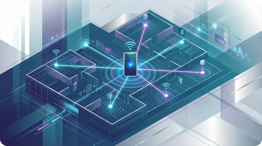
An indoor positioning system (IPS) is a network of technologies that determines the real-time location of a person or device inside a building. Rather than relying on GPS signals, IPS uses hardware infrastructure and software algorithms to pinpoint location and guide movement through complex indoor environments.
IPS powers turn-by-turn indoor navigation, real-time location tracking, foot traffic analysis, and dynamic routing. These are capabilities that standard static maps simply cannot deliver. The technology is increasingly common in airports, shopping centers, university campuses, and large commercial properties.
The Core Technologies Behind IPS
Not all indoor positioning systems are built the same. Each underlying technology offers different tradeoffs between accuracy, cost, and deployment complexity. Here is how the most widely used approaches compare:
| Technology | Accuracy | Range | Infrastructure Cost | Best Use Case |
|---|---|---|---|---|
| Bluetooth Low Energy (BLE) Beacons | 1 to 3 meters | 10 to 30 meters | Low to moderate | Retail, shopping centers, events |
| Wi-Fi Positioning | 3 to 15 meters | Wide area | Low (uses existing network) | Large campuses, airports, hospitals |
| Ultra-Wideband (UWB) | 10 to 30 cm | 50 to 100 meters | High | Logistics, high-security facilities |
| RFID | Centimeter-level (passive) | Very short | Moderate | Asset tracking, warehousing |
| LiDAR-assisted mapping | Environment modeling | Full venue | High (scanning equipment) | 3D spatial accuracy, high-fidelity maps |
For most commercial venues, BLE beacons and Wi-Fi positioning offer a practical starting point. UWB delivers superior precision but typically requires significant hardware investment. LiDAR, meanwhile, is becoming increasingly relevant not just for asset tracking, but for building the high-fidelity spatial models that make accurate indoor navigation possible.
Key Implementation Considerations
Deploying an indoor positioning system is not a plug-and-play process. Before committing to a technology stack, venue operators should evaluate the following:
- Venue size and layout complexity. A single-floor retail store requires a simpler setup than a multi-terminal airport or multi-building campus. Floor count, layout irregularities, and dead zones all affect hardware density requirements.
- Accuracy thresholds. A 3 to 5 meter margin works for general wayfinding in a mall. A hospital directing patients to specific exam rooms may need sub-meter precision. Define your accuracy requirement before selecting a technology.
- Existing infrastructure. Venues with robust Wi-Fi networks already have a viable positioning foundation. BLE beacon deployments require additional hardware but layer on top of existing systems without major renovation.
- Data privacy and security. Real-time location tracking involves personally identifiable movement data. Any IPS implementation should comply with applicable privacy regulations and include clear visitor consent mechanisms.
- Integration requirements. An IPS that operates in isolation delivers limited value. The most impactful deployments connect location data to analytics dashboards, directory systems, and custom integrations that feed insight back to operations and marketing teams.
Frequently Asked Questions About Indoor Positioning
Does an indoor positioning system require internet access to function? Most IPS solutions rely on network connectivity for real-time data processing and analytics. Some offer offline fallback modes for basic navigation, but full functionality (including live foot traffic data and dynamic routing) typically requires an active connection.
How long does IPS implementation take? Timelines vary based on venue size and technology choice. A BLE beacon network for a mid-size shopping center can often be operational in weeks. LiDAR scanning adds time upfront but eliminates ongoing accuracy issues caused by layout changes. Platforms with self-service management tools reduce the operational burden significantly after launch.
Can an IPS work with existing wayfinding kiosks and mobile apps? Yes, and it should. A positioning system that cannot push data to digital kiosks or mobile interfaces misses the most visible use cases. The most effective IPS implementations connect location data to every visitor touchpoint in the venue.
Where MapVX Fits In
MapVX approaches indoor positioning as an integrated capability, not a standalone feature. Built on a LiDAR scanned 3D mapping foundation, the platform captures precise spatial data at the environment level before any positioning layer is added. IPS accuracy depends on the quality of the underlying map, and LiDAR-based models are among the most geometrically accurate available.
For venues ready to go further, MapVX offers a real-time IPS add-on that connects live location data to the platform’s spatial analytics engine. Operations teams gain visibility into foot traffic patterns, dwell time hotspots, and flow inefficiencies, all updated in real time. Marketing and property teams can use that same data to improve tenant placement, optimize ad zone performance, and understand how visitors actually move through the space.
What distinguishes this approach is the connection between positioning data and actionable insight. Knowing where visitors are is useful. Knowing where they linger, where they get lost, and where they convert is what drives decisions.
Choosing the Right Foundation
When evaluating indoor positioning systems, the technology itself is only part of the equation. The platform it connects to determines whether that data becomes actionable insight or simply sits in a dashboard no one checks.
Look for a solution that offers:
- Accurate spatial modeling as the base layer
- Real-time analytics built into the core platform
- Flexible integration with existing systems and APIs
- A clear path to scale as venue needs evolve
- A deployment model that does not require months of professional services
Indoor navigation is moving from a differentiator to a standard. The venues that implement it thoughtfully, with the right technology stack and the right platform to act on the data, will have a meaningful operational and commercial advantage.
Ready to see how real-time indoor positioning works in practice? Book a demo to explore MapVX’s IPS capabilities and spatial analytics platform. Or view our plans and pricing to find the right tier for your venue.